HOW TO PLAY
From creating your callsign to dominating the leaderboard, here's the
flight plan.
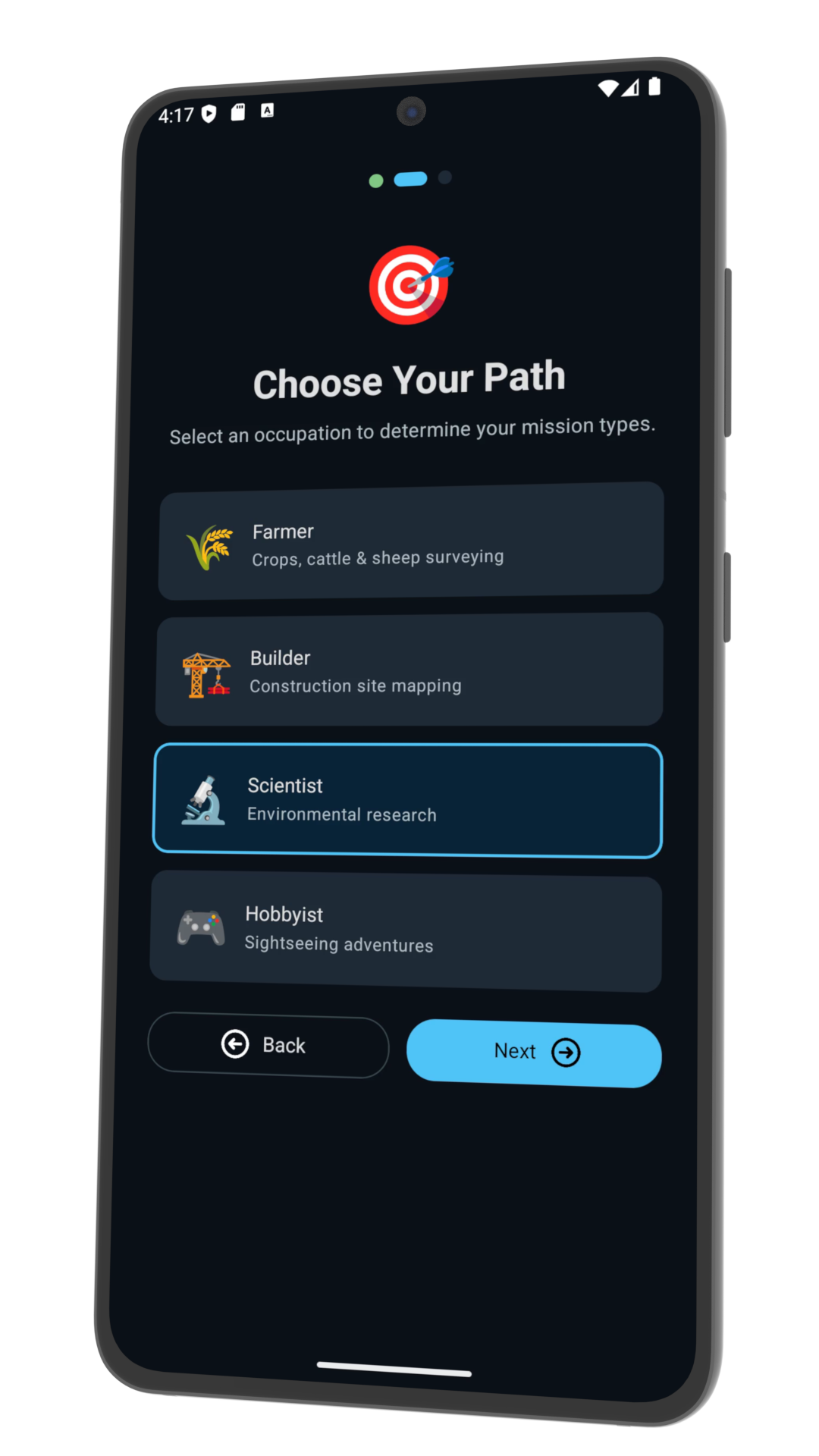
1. Career Path
Choose between Farmer, Builder, Scientist or Hobbyist. Each path
has unique missions.
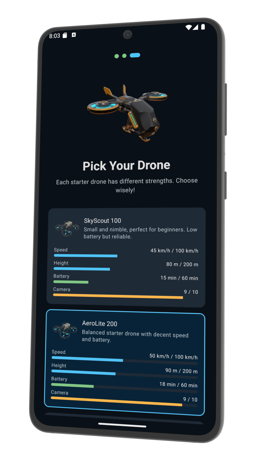
2. Pick a Drone
Select your starter drone. Each has different speed, height,
battery and camera stats.
3. Plan
Tweak speed, altitude and path rotation to maximise coins and
avoid hazards.
4. Fly
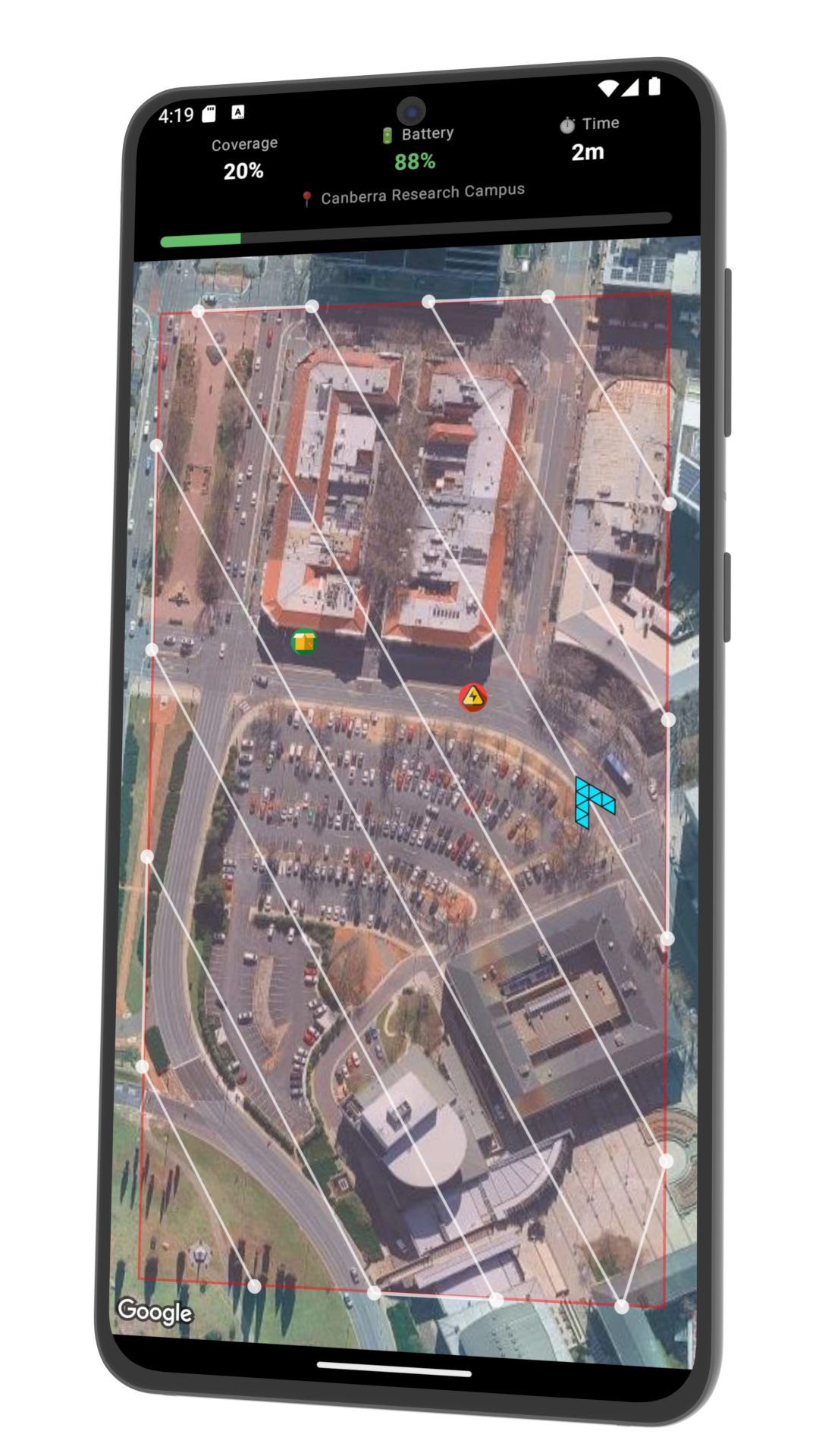
Launch your drone and watch it survey over a real satellite map.
5. Earn
Collect coins, dodge hazards and grab bonuses to rack up your
score.
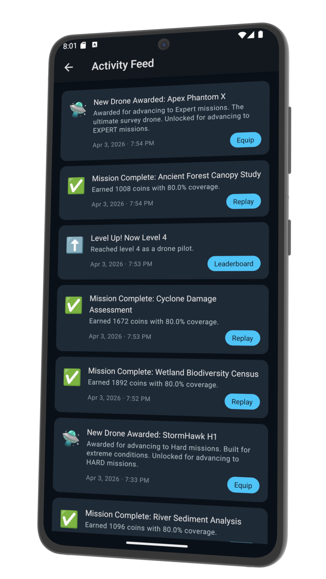
6. Feed
Check your feed to see your missions, drones and badges. Re-fly
missions or equip different drones to improve your stats.
7. Compete
Check the global leaderboard and see where you stand against
other pilots.
GAME MECHANICS
Speed Control
Push the throttle for more points, but watch your battery drain.
Fly slower to conserve power, or go full speed for a high-risk,
high-reward run.
Altitude Strategy
Fly low for better coverage but longer flight times, or climb high
to finish faster with reduced coverage. Find the sweet spot to
maximise your score.
Path Rotation
Rotate your flight path to line up with bonus zones and steer
clear of hazards. A well-angled survey can be the difference
between a top score and a failed mission.
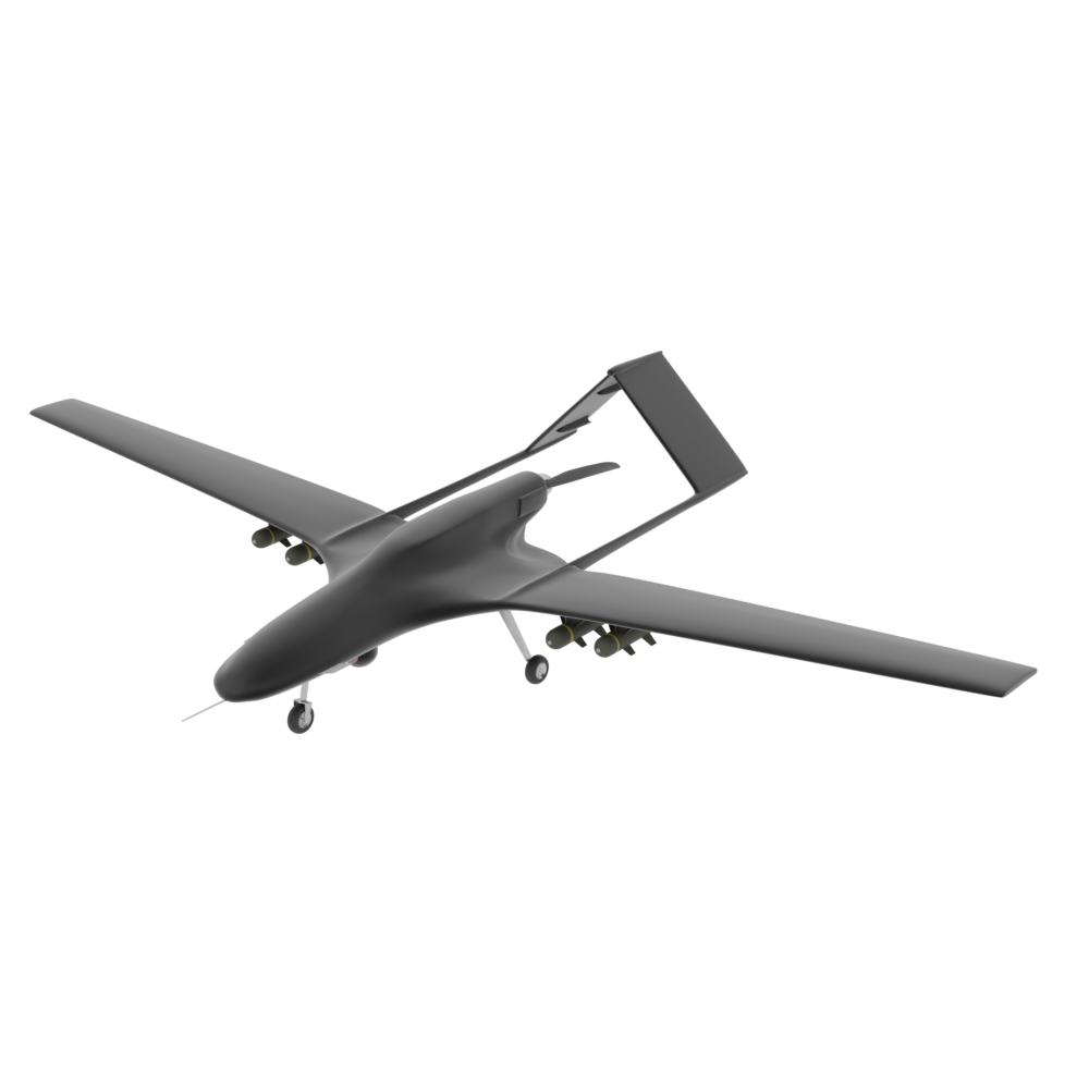
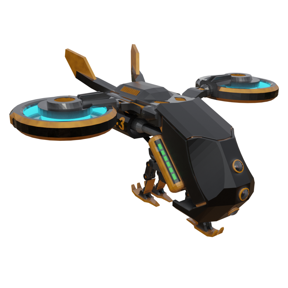
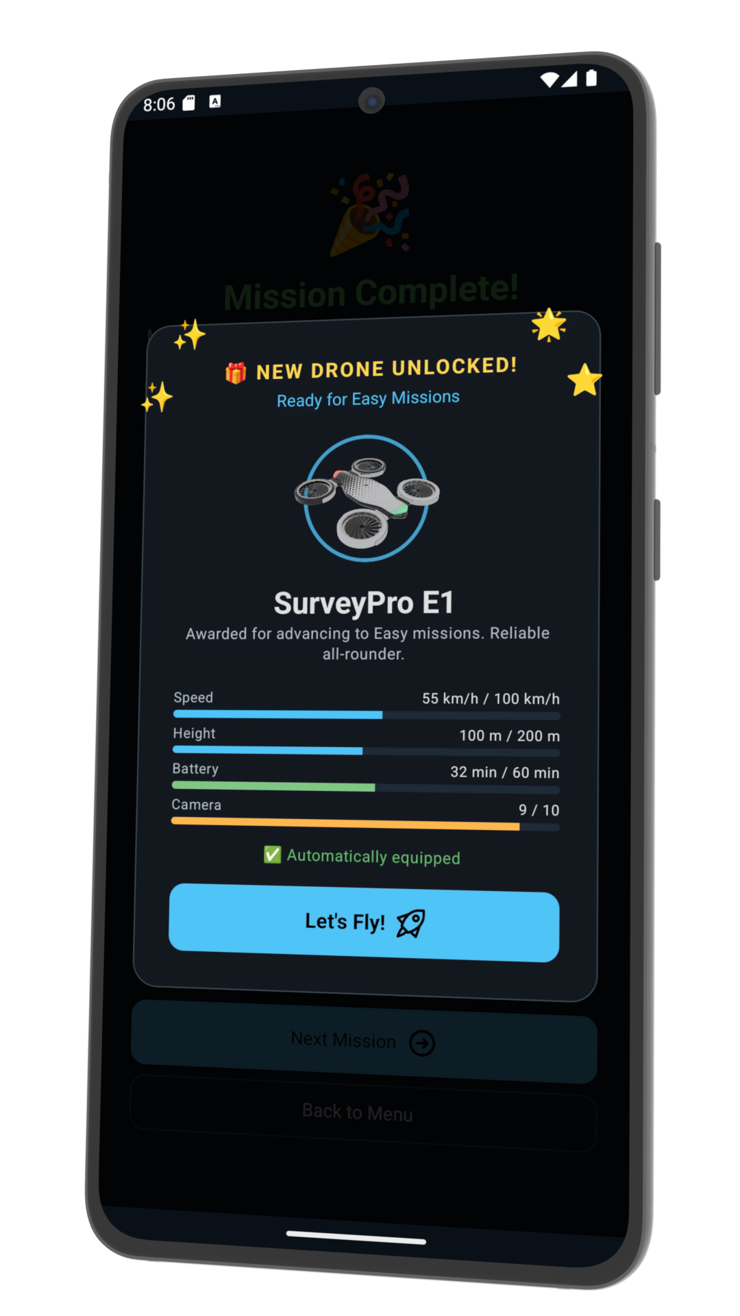
Drone Fleet
Start with a basic drone and unlock more powerful aircraft as you
progress. Each drone has unique stats: max speed, max height,
battery capacity and camera quality.
Battery Management
Every mission has a flight time. Push too hard and you'll drain
your battery before the survey is complete. Balance speed and
distance to stay airborne.
Hazards & Bonuses
Hazards lurk across the survey area and will deduct points on
contact. Bonuses are scattered for pilots brave enough to adjust
their path. Risk it all for the top score.
Real Satellite Maps
Every mission flies over real-world satellite imagery. Survey
farms, construction sites, coastlines and landmarks. The terrain
changes with your career path.
Difficulty Progression
Start on an intro mission then tackle EASY, MEDIUM, HARD and
EXPERT levels. Each tier introduces tighter constraints, more
hazards and bigger rewards.
CAREER PATHS
Choose your specialisation. Each career path has its own set of
missions and terrain.
🌾
Farmer
Survey crop fields and agricultural land. Map irrigation patterns
and monitor vast paddocks from the air in missions designed for
precision farming.
🏗️
Builder
Fly over construction zones and building sites. Navigate dense
urban environments and capture progress data on large-scale
infrastructure projects.
🔬
Scientist
Conduct aerial research surveys over coastlines, forests and
geological sites. Gather critical environmental data across remote
and challenging terrain.
🎮
Hobbyist
Sightseeing missions over iconic landmarks like the Sydney Harbour
Bridge. Fly for fun and capture stunning aerial views in a more
relaxed campaign.
COMPETE & CONNECT
It's not just about flying. It's about where you stand.
🏆
Global Leaderboard
View global stats across all AeroPlot pilots. See how your scores,
missions and drone collection stack up against the competition.
Climb the ranks and claim the top callsign.
👤
Pilot Profiles
Tap any callsign on the leaderboard to view their full feed:
missions passed or failed, drones awarded, and badges earned. Then
check your own feed to re-fly missions or equip a different drone.
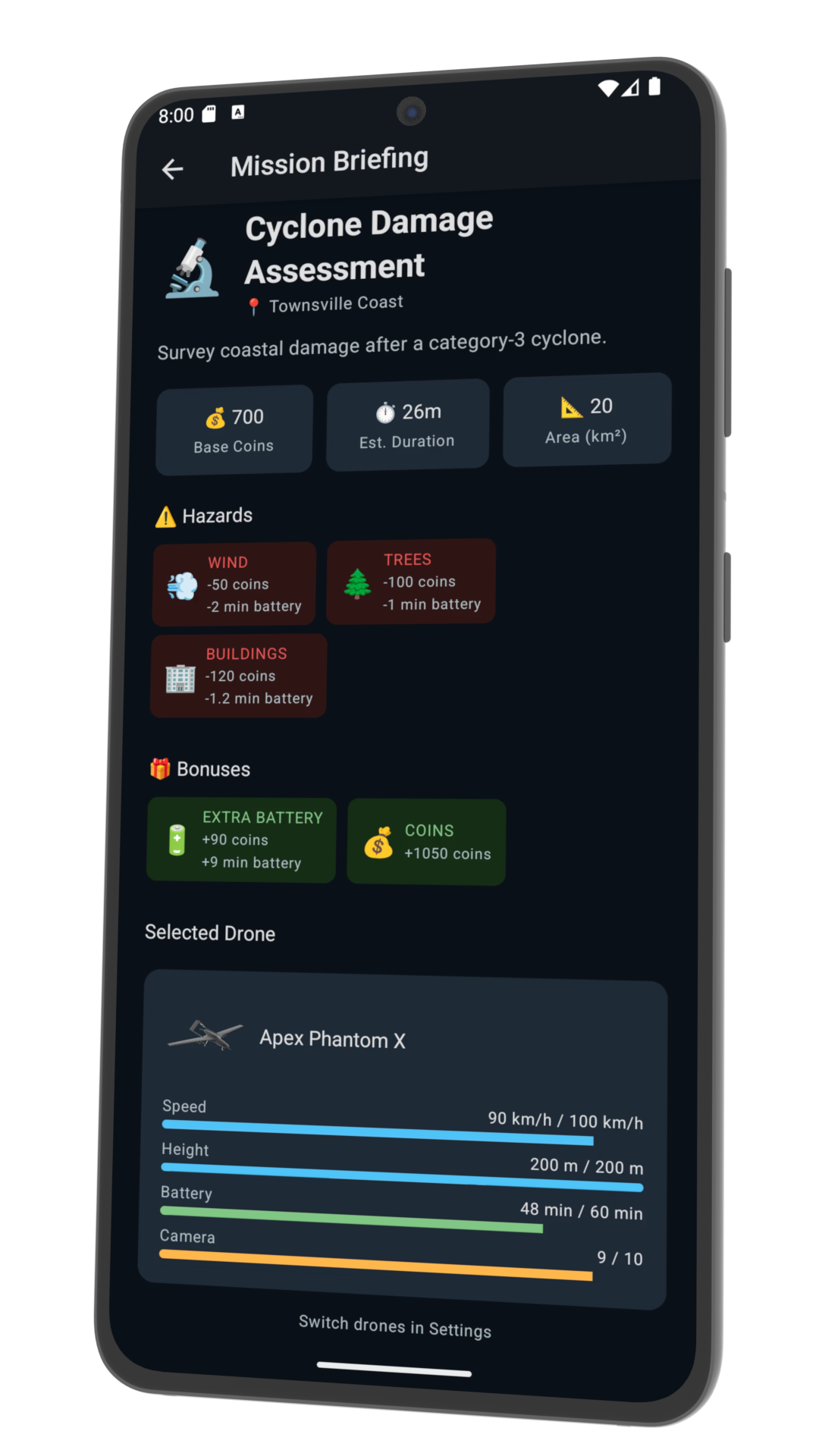
MISSION BREAKDOWN
01
Choose Your Setup
Create your callsign, pick a career path and select a starter
drone. Your career determines the missions you'll fly and the
terrain you'll survey, from farmland to city skylines.
02
Tweak Flight Parameters
Before every mission, dial in your drone's speed, altitude and
path rotation. Higher speed means more points but faster battery
drain. Lower altitude gives better coverage but takes longer. Find
the balance that maximises your coin haul.
03
Fly the Survey
Launch the mission and watch your drone fly the planned survey
over a real satellite map. Collect bonuses, avoid hazard zones,
and keep an eye on the flight timer. Every mission has a set
flight time based on your parameters.
04
Collect & Progress
Earn coins based on your performance, unlock new drones as you
reach higher difficulty tiers, and collect badges along the way.
Progress through EASY, MEDIUM, HARD and EXPERT to prove you're the
best pilot on the leaderboard.
MISSION INTEL
HOW DOES SCORING WORK? +
Every mission awards base points guaranteed to exceed any hazard
deductions, so you can always finish with a positive score.
Beyond that, your coin haul depends on three factors:
-
Speed: Faster flights earn more points but
drain battery quicker.
-
Altitude: Flying higher finishes sooner but
reduces coverage; lower altitude covers more but takes longer.
-
Hazards & Bonuses: Hazards deduct points on
contact. Bonuses scattered across the survey area reward
pilots who optimise their path rotation.
WHAT ARE THE CAREER PATHS? +
You choose one of four specialisations at the start of the game,
each with its own unique missions and terrain:
Farmer
Survey crop fields and agricultural land.
Builder
Fly over construction zones and building sites.
Scientist
Conduct research surveys over coastlines and forests.
Hobbyist
Sightsee over iconic landmarks like the Sydney Harbour
Bridge.
HOW DO DRONES DIFFER? +
Each drone has four core stats that affect gameplay:
-
Max Speed: Faster drones earn more points per
flight.
-
Max Height: Higher ceiling means you can
finish surveys faster.
-
Battery Capacity: Larger batteries let you
fly longer before running out of juice.
-
Camera Quality: Better cameras improve your
coverage score.
You start with a choice of three starter drones, each with its
own strengths and trade-offs. As you progress through difficulty
levels, new and more powerful drones are awarded.
WHAT ARE THE DIFFICULTY LEVELS? +
The campaign starts with an intro mission to learn the ropes,
then progresses through four difficulty tiers:
EASY, MEDIUM,
HARD and EXPERT. Each tier
introduces tighter constraints, tougher hazards and bigger
rewards. New drones are unlocked as you advance.
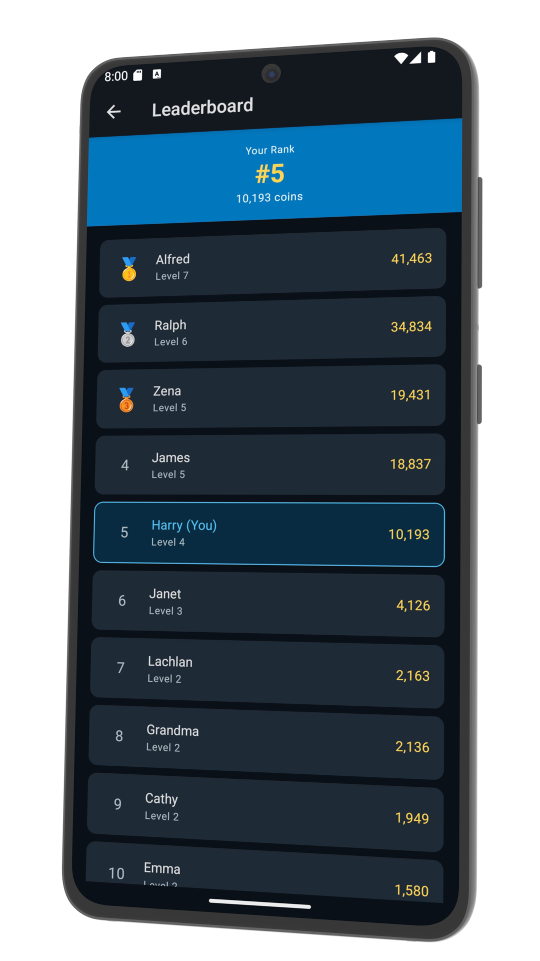
HOW DOES THE LEADERBOARD WORK? +
The global leaderboard ranks all AeroPlot pilots by their
cumulative stats. Tap any callsign to view their full profile:
missions passed or failed, drones awarded and badges earned. You
can also browse your own feed, re-fly previous missions, or
equip a different drone from your collection.
READY TO FLY?
Create your callsign, choose your career and start earning coins.